
Get a Free Climate Risk Report for Any Address
See exactly what insurers, underwriters, and risk managers use to assess climate exposure - for any location you choose.
-
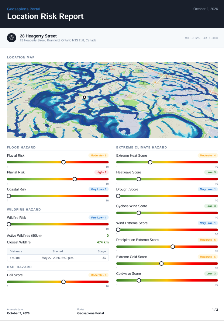
Flood, wildfire, hail & climate hazard scores - address-level precision
-
A clean, shareable PDF report
-
Only the address is needed to generate this analysis
Fill out this form to receive your report. No sign-up required. No commitment.
Book Your Personalized Demo Call
See how Geosapiens can work for your business - pick a time that suits you and let's talk.
Frequently asked questions
What is included in the free climate risk report?
Your report includes address-level hazard scores for flood (riverine, surface water, and coastal), wildfire, and other climate perils — delivered as a clean, shareable PDF. It reflects the same data models used by Canadian insurers and underwriters to assess climate exposure.
How quickly will I receive my report?
Once you submit the form, your climate risk report is generated and delivered within 48h. No sign-up, account creation, or commitment is required.
Is my address data kept confidential?
Yes. The address you submit is used solely to generate your climate risk analysis. It is not stored, shared, or used for any other purpose.
What types of flooding are covered in the report?
The report covers three types of flood risk: riverine flooding (overflowing rivers and watercourses), surface water flooding (intense rainfall overwhelming drainage systems), and coastal flooding (storm surges, sea level rise, and tidal variations).
How accurate is Geosapiens' climate risk data?
Geosapiens' climate risk models deliver risk at the property level across Canada, so each address is assessed on its own exposure rather than a regional average. Our models are validated against industry benchmarks and historical event data, so their results reflect observed losses and real-world conditions.
How can this data improve my underwriting process?
Geosapiens' property-level risk scores allow underwriters to move beyond broad regional estimates and assess individual locations with precision — enabling more accurate pricing, tighter risk selection, and stronger portfolio management.
Does Geosapiens cover the entire country, or only certain provinces?
Geosapiens' models provide nationwide coverage across all Canadian provinces, from British Columbia to Newfoundland. You can generate a report for any property address in Canada.
How is Geosapiens' data delivered for enterprise use?
Beyond this free report, Geosapiens offers its risk models via API integration and a web portal, enabling insurers, municipalities, and professionals to analyze risk at both the individual property and full portfolio level.
What makes Geosapiens different from other climate risk providers?
Geosapiens is a Canadian company whose models use scientific, peer-reviewed methods, and it is the only Canadian firm offering flood, wildfire hail and extreme climate models at a national scale. The models are built for Canada using local data and expertise, so they fit Canadian climate conditions and insurance market needs. Clients get flexible delivery through the Portal or the API, which plugs into their existing workflows, and the methods behind the models are transparent so clients can see how each risk score is produced.